Campus security has evolved from a barely noticed function into a crucial part of educational institutions. The late 1960s campus unrest and the Crime Awareness and Campus Security Act of 1993 pushed institutions to take a more detailed approach to personal safety.
Recent statistics paint a concerning picture. About 82% of college students worry about their personal safety, and more than half say they are very worried. High school seniors share similar concerns, with 62% expressing anxiety about campus safety. Parents also feel uneasy, as 38% worry about their child’s physical safety at school. These safety concerns shape enrollment choices significantly. A 2022 survey showed that 60% of undergraduate and graduate students considered campus safety a major factor in choosing their school. Schools that make security a priority often attract more students during recruitment.
Educational institutions face many threats today. These range from violence and sexual assault to complex cybersecurity issues. K-12 schools saw ransomware attacks jump by 92% in 2024. The education sector endured 217 ransomware attacks between 2023-2024, showing a 35% increase from the previous year. Security measures need careful planning. Studies show that too many security measures can make people feel less safe and might lead to lower test scores and reduced college enrollment. Campus safety helps students succeed academically. This makes well-planned emergency preparedness vital for every educational institution.
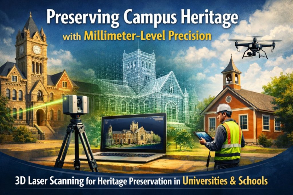
Using 3D Scanning for Emergency Evacuation Planning
3D scanning has become a game-changing tool for emergency preparedness at educational institutions. This technology creates detailed digital replicas of campus environments and provides unmatched accuracy for evacuation planning.
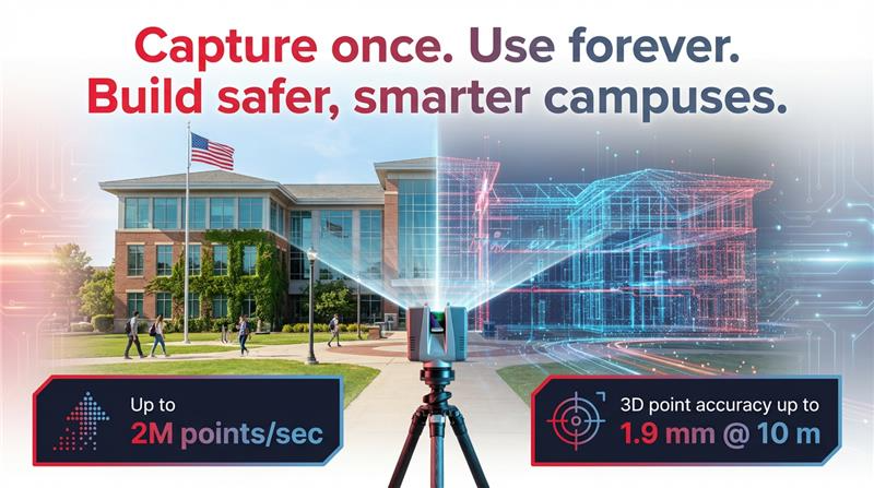
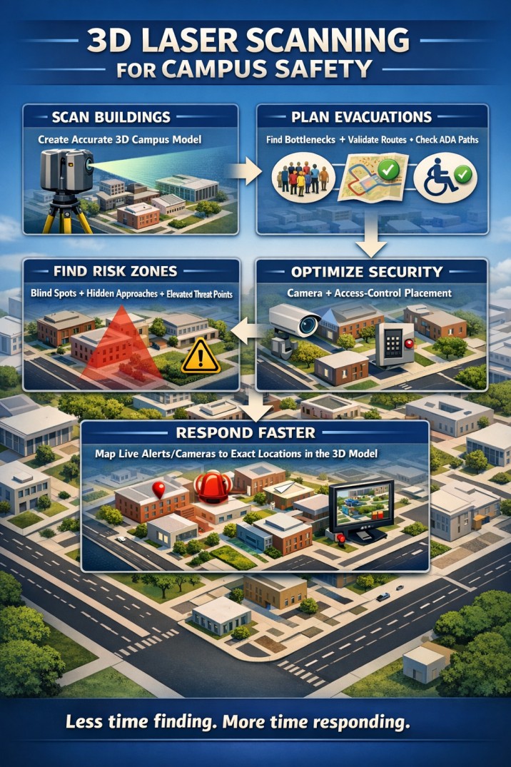
Safety officials can use 3D laser scanning to spot potential bottlenecks and hazards that 2D floor plans might miss. These scans deliver measurements with millimeter accuracy. This precision helps planners calculate exact evacuation times based on real spatial dimensions instead of estimates.
This technology makes emergency evacuation route mapping much more effective. Schools can also:
- Run virtual tests of different evacuation scenarios before putting them into practice
- Choose the best spots for emergency signs and equipment
- Set maximum occupancy limits using actual space measurements rather than just building codes
- Study how people move during emergency simulations
The system helps with accessibility planning by spotting possible barriers for students who have mobility challenges. These 3D scans help schools meet ADA requirements and ensure every student has a clear path to safety.
Emergency response teams ended up using these detailed models to learn campus layouts before arriving at the scene. Response times improve during real emergencies, especially when you have complex campus setups with multiple buildings, underground passages, or unique architectural features.
Identifying Risk Zones with Accurate Campus Models
Security teams can’t protect what they can’t see. Today’s campus layouts create countless angles, heights, and hidden approaches that regular planning methods are nowhere near good enough to assess.
3D models give security administrators a way to get into campus layouts from multiple viewpoints and instantly show weak points. These models point out:
- Blind zones with poor surveillance coverage
- High points that could become threat positions (rooftops, balconies, windows)
- Hidden approaches where people could move undetected
- Building features that create security gaps
3D scanning helps find areas with poor visibility, which helps teams place security cameras and access control points better. A real-life example shows how analysts used rooftop viewshed modeling before a championship event and found temporary sponsor banners blocking two perimeter cameras, a dangerous blind spot in a busy area.
3D visibility tools do more than just show what’s there. Security planners can test scenarios and confirm their ideas before making physical changes. This leads to better operational readiness and faster threat detection.
The detailed models make it easier to combine existing security systems with spatial data across campus. This gives teams up-to-the-minute data analysis during emergencies. Regular visual checks often miss subtle weak points, but 3D scanning gives a full picture of risks and ended up improving overall campus safety planning.
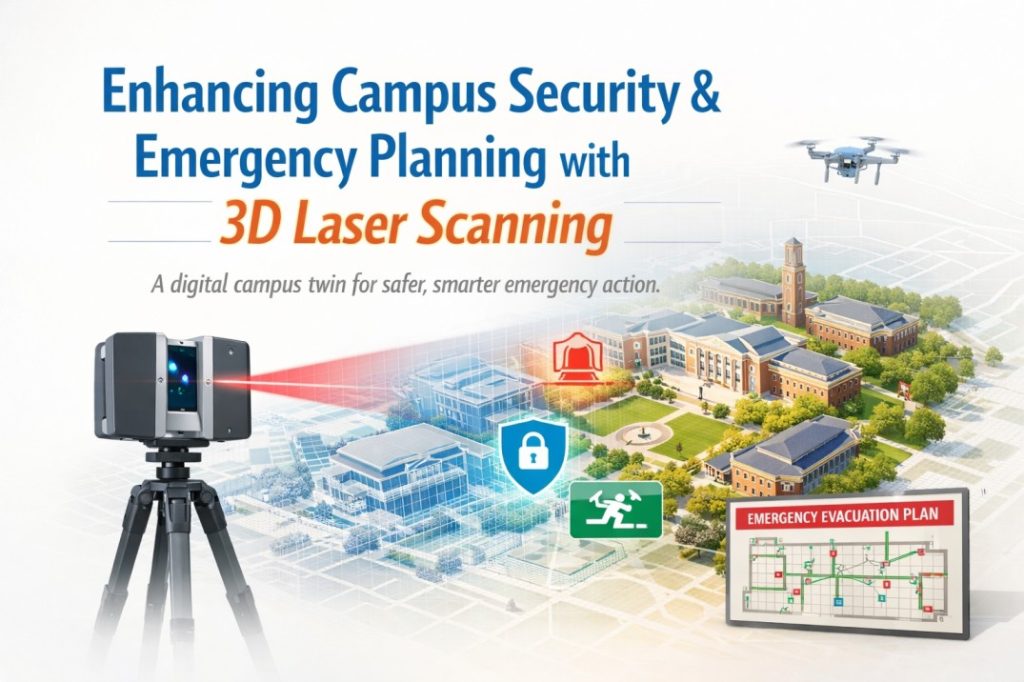
Integrating Scan Data with Security & Monitoring Systems
3D scanning technology becomes more powerful when it blends with existing campus security systems. Smart integration gives security teams up-to-the-minute awareness that connects static models with active monitoring.
Security staff can now:
- Watch live camera feeds on 3D models for better monitoring
- Connect access control systems with spatial data to spot threats quickly
- Use motion detection with exact location tracking
- Link alarm systems to precise spots in the 3D model
This combination creates a unified security system instead of separate parts. The benefits become clear during emergencies when time is critical. Security officers can pinpoint an alert’s exact location in the campus’s 3D layout right away.
The system helps at every stage of emergency management – from planning to response and recovery. First responders can check accurate building layouts before going in, which cuts down confusion by a lot.
Daily operations improve with this approach too. Security managers can study past incidents in their spatial context and find patterns they might have missed before. Schools and universities find these features more valuable as they look for better ways to plan campus safety with reality capture tools. Smart planning drives emergency preparedness in educational institutions. 3D scanning technology serves as a valuable investment that goes beyond a simple technical upgrade. Building a detailed campus emergency plan begins with proper documentation. The team must capture each facility’s current state before making any security improvements.
Emergency response teams can use digital replicas from these scans to run simulation exercises. The virtual drills help staff practice emergency protocols without disrupting campus life – a clear advantage over old training methods.
The scanning work reveals hidden aspects of campus layout. Security personnel discover maintenance tunnels, structural changes, and concealed spaces missing from building plans. These findings fill important security gaps. Updated scans give emergency responders the latest campus details. This becomes valuable when institutions expand or renovate their facilities. School leaders should weigh the upfront costs against future safety benefits. The protective value makes sense as scanning technology becomes more economical and available to smaller schools. Careful planning and execution of 3D scanning creates safer learning spaces. Emergency readiness becomes part of everyday campus life.
Real-World Examples of Safer Campuses through 3D Scanning
Across the U.S., schools and public safety agencies are using 3D laser scanning to reduce confusion during emergencies and speed up response. In Texas, the Fort Worth Police Department has scanned high-traffic public venues, including areas around major campus and event settings, so officers can preview layouts, entrances, corridors, and key access points before arriving on scene. That kind of “pre-incident” spatial intelligence is especially valuable when responders are unfamiliar with the location or when crowds make navigation difficult.
In Illinois, an indoor mapping initiative demonstrated how detailed 3D-informed building layouts can translate into real time saved. During a student medical emergency, responders used mapped interior access information to reach the correct entrance instead of defaulting to the main entry, cutting several minutes off the response path, time that can be critical in life-threatening situations.
Conclusion:
Beyond day-to-day emergencies, 3D capture also supports recovery and reconstruction after major incidents. A widely referenced example is Notre-Dame in Paris, where high-accuracy laser scans captured prior to the 2019 fire provided reliable geometric documentation that helped guide restoration planning. For educational institutions, the takeaway is clear: scanning isn’t only about better planning, it’s also about creating a dependable digital record that supports response, investigation, and rebuilding when the unexpected happens.
Taken together, these examples point to a clear pattern: when responders have an accurate, building-level spatial model before an incident happens, they spend less time “finding” and more time “doing.” The Fort Worth approach suggests that pre-scanned, high-occupancy environments reduce uncertainty in chaotic conditions. The Illinois school mapping outcome implies that even small navigation gains, like choosing the correct entrance immediately can translate into meaningful improvements in medical outcomes and crisis control. And the Notre-Dame case reinforces a broader resilience takeaway: high-fidelity reality capture isn’t only a response tool; it’s a continuity asset that supports investigation, restoration, and future risk mitigation.
The practical inference for campuses is that 3D scanning creates compounding value: it strengthens everyday readiness (routes, access, visibility, equipment placement), improves real-time coordination (faster orientation and decision-making), and enhances long-term recovery (reliable documentation when plans are outdated or incomplete). In other words, scanning doesn’t just “add a model”, it reduces the most common failure point in emergencies: incomplete situational awareness.