Geographic Information System (GIS) Mapping & Surveying
Geographic Information System (GIS) mapping and consulting services in Dallas, Texas and New York, USA. At TopBIM, we automate GIS data generation and convert it to BIM-ready formats empowering smart, location-focused construction and infrastructure management.
GIS Technologies Used for Dallas & New York Projects
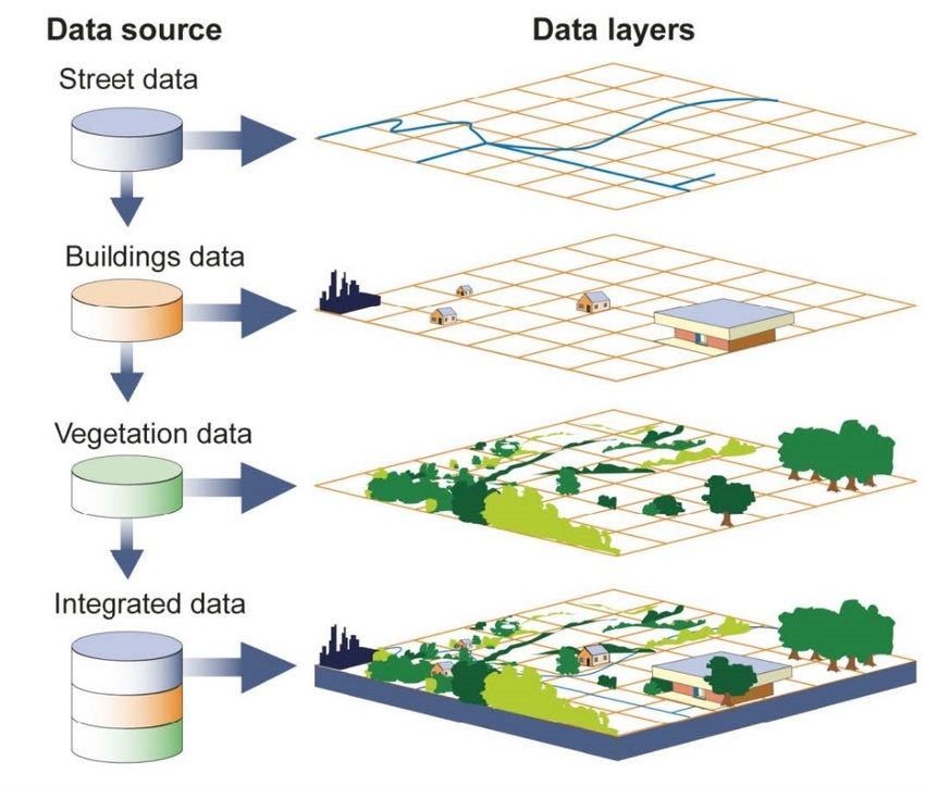
GIS deploys geospatial technologies or integrates other information systems for leveraging the visualization of geospatial data
Remote Sensing
Remote sensing technologies are deployed to scan the physical information about the targeted area. Technologies used to assist in remote sensing are satellites, drones, LiDAR, and photogrammetry.
Internet of Things (IoT)
The Internet of Things is the network of smart devices that works to amplify the work of GPS in GIS. The GPS receiver is the central component of this context. These technologies facilitate the collection of geographical data
Global Positioning System (GPS)
GPS brings in the particularity to map’s data. It is for capturing and documenting real-time data on a specific location.
GIS integration and visualization
The integration of GIS tools with other application workflows and putting them in a comprehensive visualization comes under this service.
Ignite your construction projects with our unparalleled GIS services.
From site selection to project management, we leverage spatial intelligence
With more than 151+ projects we have done so far, the majority of them were large public infrastructures. TopBIM delivers these core GIS services across Dallas, TX and New York, USA:
GIS Data Capture
Converting the captured geographical data into computer-readable form. This data is then manipulated on GIS mapping software for integration and deployment.
LiDAR Data Processing Services
We process, analyze, and visualize the GIS mapping data collected by light detection and ranging sensors in our drawing environment.
Parcel Mapping
Parcel maps also touted as property maps are particularly used for the explicit demarcation of properties on the map.
Digital Photogrammetry Services
Interpreting multiple photographs captured by remote sensing technologies, to a sensible 3D model that can be utilized in your BIM workflow.
Topographical Mapping
Topographical maps are intended for recording detailed physical attributes such as positioning and elevation, for a particular area of landmass.
GIS mapping
We transform the GIS data into a comprehensible digital map format from multiple sources.
GIS Data Conversion
This process acts as a central component in the whole GIS service for building development. The collected GIS data can be translated into multiple formats as per their suitable use.
GIS Process - Tailored for Dallas & New York Projects
Set Objectives
Before starting on any GIS requirement, we determine the precise goal of the project.
Integration
Tuned to this, the use of tools and workflow integration is figured out.
Data Extraction
Then, the right set of data has to be sought out to visualize the tangible stakes on the project site.
visualization
Finally, the most suitable BIM and GIS integration workflow benefits the project with the data extracted and further visualized.
Why Choose TopBIM for GIS in Dallas & New York?
With this much experience, we can deploy datasets from our past project to optimize the BIM-GIS integrated workflow
Understanding of the latest GIS practices
Not only the selection of state-of-the-art tools but also the human pool that has experience in managing the most complex GIS requirements
Pace and perfection of your project
In general, GIS is needed for big AEC public infrastructure projects. Therefore, with our in-house skillset, we keep up with the pace and perfection required for the project.
A trustable BIM company that integrates GIS workflows
GIS has varied applications but if you specifically need it for design-build operations, Top BIM Company has got all that it takes to deliver the expectations.
Integrating GIS with your BIM modeling interface for better decision making
Enhance design decision-making and streamline intelligent development effortlessly through our rapid BIM-GIS integration.
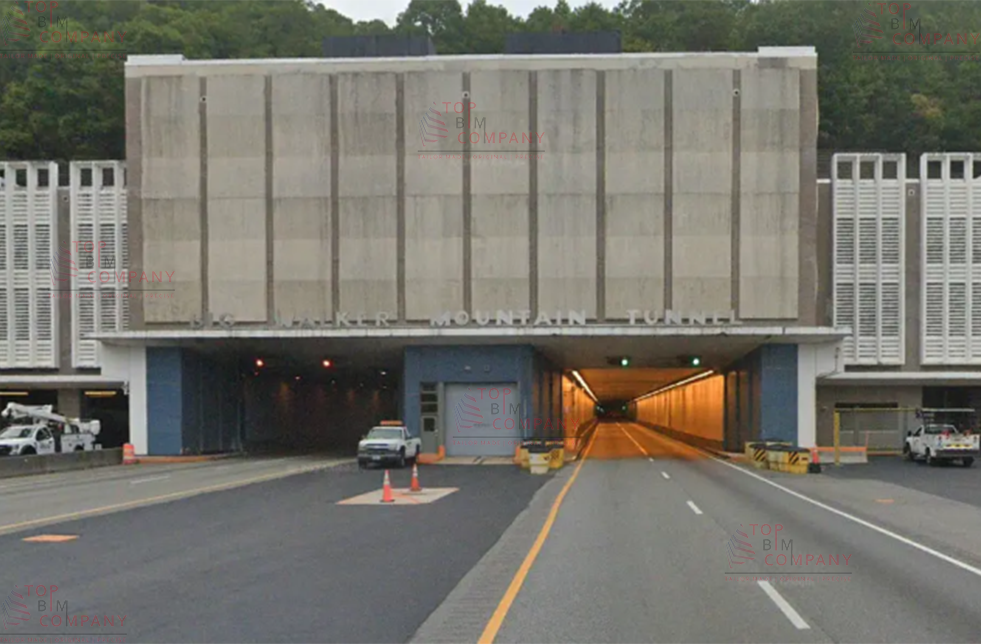
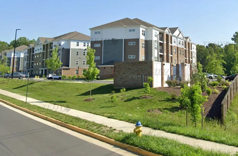
Delivered Scan-to-BIM and as-built modeling services for VDOT’s Big Walker Mountain and East River Mountain Tunnels, including tunnel approaches, utilities, and facility structures, supporting renovation planning, permit approvals, and long-term infrastructure management.
The objective of the Property Restoration project was to develop a comprehensive & data-rich architectural Building Information Model of the structure.
It was a private residential space project. The client was facilitated with layouts, images of the property, and a data-rich architectural BIM model of the project.
LC is an architectural BIM project developed by TopBIM company. We offered a comprehensive architectural BIM according to the client requirement of LOD 350.
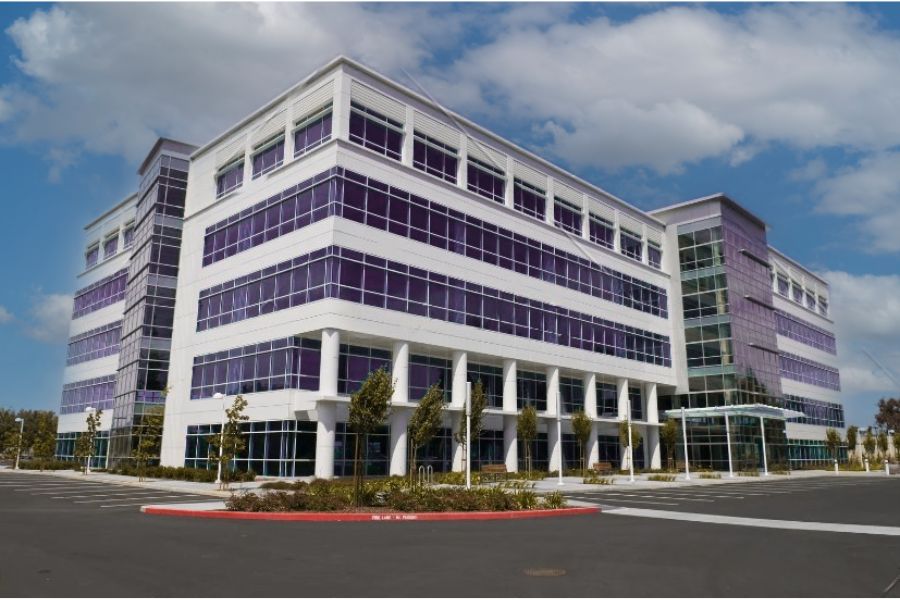
Office Building Project is a structural BIM project completed by TopBIM Company. The expert team took 6 months to complete the whole project, offering LOD 350 BIM model.
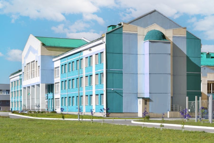
An elementary school located in the USA. Our responsibility for the educational building was to create a BIM model for the mechanical systems of the building.
Supercharge your data analysis and decision-making with our advanced GIS services
Don’t miss out on the endless possibilities GIS has to offer. Contact us now and let’s shape a smarter future together!
Our offerings include GIS data capture, LiDAR processing, parcel mapping, photogrammetry, and conversion to BIM-ready formats - deployed in both Dallas, TX and New York, USA.
Let’s discuss your project scope, local data layers, regulatory needs, and deliverable formats specific to your region - whether Manhattan’s urban environment or Dallas’s metropolitan infrastructure.
When evaluating GIS service providers, one should consider their experience especially their ability to handle large complex projects. Second, your operations need and location should be compatible with your selected GIS service provider. This can be analyzed through the provider’s clientele and past work.
Costs depend on factors like data type, area coverage, complexity, and format. Typical SDS - based scanning or mapping rates vary between TX and NYC markets. Contact us with your zip code for a custom quote.
Get a Free Quote
Get a Free Estimation for your Project
Please fill up the form to discuss your detailed project requirements and building design needs and we will get back to you soon.
Get a Free Estimation for your Project
Please fill up the form to discuss your detailed project requirements and building design needs and we will get back to you soon.