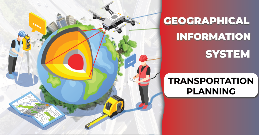
GIS research integrates geographical and non-spatial data to solve real-world problems. Field-based and object-based data models are used, representing geographic space as discrete objects or continuous combinations of real-world characteristics.
GIS-T research uses object-based and field-based models, with field-based models better for linearly referenced data and object-based models for network research.
GIS-T software has developed enterprise and multidimensional models for transportation-related applications, combining temporal, 2-D, 3-D, and 1-D data.
")
Image source: gis.stackexchange.com
Cloud computing applications simplify system design and storage. Location-aware technology enables large-scale data gathering, creating new challenges in GIS-T research. GIS-T is essential for efficient transportation data expression.
GIS-T Analysis and Modeling

GIS-T applications use standard GIS functions for data management, analysis, and visualization, but transportation has developed unique analysis methods and models. Commercial GIS software offers basic procedures, but travel demand models are only available in select packages. Understanding these methods improves GIS-T design and analysis capabilities.
In the fields of logistics and transportation, GIS-T applications play a critical role in
- Routing
- Vehicle tracking
- Fleet management
- Site selection
- Infrastructure planning
- Economic impact assessment, safety analysis
- Travel demand analysis
- Traffic monitoring
- Public transit planning
Different application demands are addressed by research on multidimensional and enterprise GIS-T data models. There are many uses for driving instructions and logistics as a result of the Internet’s and cellular communications’ explosive expansion. Following are the applications of GIS in transportation planning explained in detail –
Also Read – GIS Mapping Software For Construction Industry
Infrastructure Maintenance and management
The magnified GPS images coupled with GIS could provide real time performance insights on the infrastructure developed. Transportation infrastructural assets like highways and roads have heavy budgets to be take care of. With precise usage and condition imageries coupled up with predicted usage data, government authorities with stakeholders can better upgrade the infrastructure.
- The whole cycle to infrastructure management and maintenance looks like –
- Generating the real-time asset performance with accurate public felicitation imagery data
- Assessment of its current condition which is its physical appearance and renewal needs
- Performance projection based on population increment and current structural conditions
- Devising predictive maintenance based on the critical performance metrics
Accident response measures
The arrival of data-driven AEC tools has ensured that nothing is done on assumptions. Same is the intention with utilizing GIS on design dashboard, through GIS each of the event occurrence can be analysed better. Also, GIS aids in accident reporting by pinpointing accident locations and contributing to quick emergency responses.
- Integrating GIS with BIM dashboard is intended towards minimizing the unfortunate incidents. However, even if the accident occurs GIS aids in –
- Identifying the exact location and root cause of the incident
- Running multiple simulation on predicted solutions
- Then finally couple solutions with user behaviour to derive a final optimal development
Optimized route planning

Image Source: Researchgate
The best argument in the favour of BIM-GIS integrated workflow for transportation planning would be intelligent traffic simulation. Recorded traffic behaviours over a period of time can provide data to predictive AI-systems to have a slate for planning routes. This specific approach can help in improving traffic flow, reduction in transportation bottlenecks, and transportation infrastructure design enhancement.
GIS aids in –
- Route accessibility data analysis
- Plugging in with real-time GIS and rich demographic data
- Devising optimized route design
Environmental Impact Assessment
GIS data is all about geographic data i.e., the physical and vegetative land data. The linear sustainable approach gets it all wrong with a primary focus on climatic data only. With a GIS development approach, the final output can actually respect the land topography causing a minimal impact on the environment. Even the green land restoration necessary in parallel to infrastructure development, could be fasten up with GIS. The GIS for Environmental Impact Assessment (EIA) can have following applications –
- Rehabilitation – The rebuilding preparedness with transportation infrastructure when disaster occurs
- Green land conservation – Optimizing the transportation design in such a way that it minimizes the impact on land topography
- Sustainable transport infrastructure – Democratizing a thoughtful public transport system, reducing individual carbon foot print
Logistics management
The GIS is a binding thread for all mode of transportation. Right from probing into intersection challenges for optimized fleet management and cargo monitoring to planning of transportation hubs, GIS take care of all.
For an economy to properly faction, logistics has to be smooth and that could only be achievable by Organisation of information for each of the stakeholders participating in the activities. The whole logistics management with GIS will look like –
- Identifying suitable locations for transportation hubs, incentivizing productivity throughout logistics
- Real time vehicle monitoring with introspection on critical metrics for performance
- Combining the GIS data with ERP of requirements for developing a comprehensive logistics layout