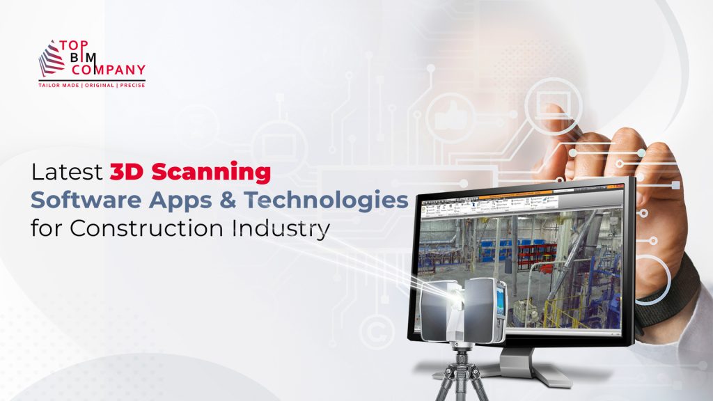
3D scanning – a popular and captivating realm! It is popular in the construction industry, healthcare, entertainment and many others. The technology uses a laser to create a 3D model of an object or environment. Now, when it comes to choosing the top-notch software that reigns supreme in this domain, never forget the importance of laser scanning.
Table of Contents
ToggleWe present a list of the best software applications. From capturing mind-blowing intricacies to providing unbelievably precise measurements, these digital wizards are sure to blow your mind away.
Our 3D laser scanning services are designed to provide you with a comprehensive view of your building project. We use cutting-edge laser scanners to capture high-resolution images and detailed point clouds of your project site.
So, gear up for a 3D scanning escapade like no other! It’s time to unlock a world where imagination meets reality, all with just a click of a button. With these exceptional software options at your fingertips, exploring limitless possibilities has never been so effortless!
This technology can be used for a variety of purposes, including:
- As-built documentation: 3D laser scanning can be used to create a detailed and accurate record of an existing structure. This can be helpful for a variety of purposes, such as planning renovations or repairs, or as a reference for future projects.
- Quality control: 3D laser scanning can be used to inspect construction sites for defects or deviations from the plan.
- Safety: 3D laser scanning can be used to identify potential hazards on construction sites, such as areas with poor visibility or unstable footing.
- Visualization: 3D laser scanning can be used to create interactive models of construction projects. This can be helpful for clients and stakeholders to visualize the finished project, and to identify potential problems early on.
Software applications are essential for the processing and analysis of 3D laser scanning data. These applications can be used to create 3D models, measure distances and volumes, and identify objects and features. There are a number of different software applications available, each with its own strengths and weaknesses.
Best Software Practices for 3D Laser Scanning in Construction
3D laser scanning is a powerful tool that can be used to improve the efficiency and accuracy of construction projects. However, to get the most out of laser scanning, it is important to use the right software.
Here are some of the best software practices for 3D laser scanning in construction:
- Use cloud-based software – Cloud-based software allows you to access your data from anywhere, which is essential for collaboration and communication on construction projects.
- Choose software that is compatible with your scanner – Not all laser scanning software is compatible with all scanners. Make sure to choose software that is compatible with your scanner so that you can get the most out of your data.
- Use software that is easy to use – Laser scanning software can be complex, so it is important to choose software that is easy to use. This will make it easier for you to capture and process your data.
- Use software that has a variety of features – There are a variety of features that can be found in laser scanning software. Make sure to choose software that has the features that you need for your project.
Most Popular Software Applications by the Construction Industry
The following are some of the most popular software applications used by the construction industry for 3D laser scanning:
- Reality Capture:

Reality Capture is a software application from Autodesk that is used to create 3D models from 3D laser scanning data. It is a powerful and versatile application that can be used for a variety of purposes.
Want to Implement the Reality Capture with Onsite Laser scanning services
- CloudCompare:

CloudCompare is a free and open-source software application that is used to visualize, measure, and analyze 3D laser scanning data. It is a powerful and flexible application that is suitable for a variety of users.
- PhotoScan:

PhotoScan is a software application from Agisoft that is used to create 3D models from photogrammetry data. It is a powerful and easy-to-use application that is suitable for a variety of users.
- Trimble RealWorks:

Trimble RealWorks is a software application from Trimble that is used to visualize, measure, and analyze 3D laser scanning data. It is a powerful and versatile application that is suitable for a variety of users.
- Leica Cyclone REGISTER 360:

This is a software solution that allows you to register, process, and analyze laser scanning data.
Latest Software Technologies of 3D Laser Scanning
3D laser scanning is a rapidly evolving technology, and the software and associated technologies are constantly being updated. Here are some of the latest software and associated technologies of 3D laser scanning:
Also Read Complete Guide on – Scan to BIM: Converting Physical Buildings into Accurate 3D Models
Photogrammetry Software:
Using Photogrammetry software, you can create 3D models from pictures. It computes, measures and converts them into 3D data using photos. Photogrammetry software is required to perform a 3D scan using a phone, drone, or camera.
- 3DF Zephyr: Due to its user interface, 3DF Zephyr is one of the top products on the market. It is incredibly user-friendly and intuitive. The 3D scanning process will be guided for inexperienced users, but 3DF Zephyr is not just for beginners. Many useful tools will be used by experts from various industries, such as the capacity to convert the model into CAD software. The 3D model can be adjusted and tweaked in a variety of ways.
- Agisoft Metashape: In addition to GIS (Geographic Information System) applications, this expert 3D scanning program is popular for game development, visual effects production, and historical research. The software has the ability to deal with aerial and close-range Photogrammetry. Agisoft Metashape is an intriguing feature that enables users to create 4D models by enabling the saving of entire scenes as editable 3D objects.
- Autodesk ReCap: ReCap stands for Reality Capture in Autodesk. To create 3D models, it employs pictures, but it can also use laser scans. It may be used for close-range and aerial scans. CAD and BIM software can be used with the 3D objects. High-quality models may be created using this 3D scanning software, and they can then be altered using specialized tools.
- Context Capture by Bentley: This is a highly effective professional Photogrammetry program that can create entire infrastructure landscapes. It will provide you with several cutting-edge tools for organizing and editing 3D models. This program is widely used for building projects since it can produce extremely realistic street views. To produce the greatest 3D models, this software can be used in conjunction with laser scanning and aerial Photogrammetry. Additionally, you may create 3D animations and fly-throughs with Bentley ContextCapture.
- Colmap: Colmap enables the creation of 3D mesh from a single camera or a collection of cameras. It is simple to use and free. There are more sophisticated methods available, particularly to raise the standard. The 3D model, however, cannot be edited with this software. For quick and simple 3D scanning, it works great.
- Drone Display:
This 3D scanning software was created specifically for drones, as the name would imply. It has two apps in it. One directs the drone’s flight path and guides it from takeoff to landing. A second program collects the images and builds a 3D model from them. You can use the tools it gives you to measure distances, volumes, and surface areas. You can also include more customized features. Check out more details from –
- IMAGINE Photogrammetry:
A reputable Photogrammetry program is IMAGINE. If you intend to use mapping 3D scans, there are some crucial factors you should take into account. It is widely utilized by the national and local mapping agencies, the commercial mapping sector, and the department of transportation. It offers users a wide range of expert tools, including several point cloud views, to help modify the photographs and handle massive amounts of data. Read more from the video.
- Meshroom: Meshroom is unique in that it has a simple learning curve. The node-based 3D scanning procedure is incredibly simple to use and produces a 3D model for you. Additionally, you have the choice to alter the nodes afterwards and modify the 3D scan to suit your requirements.
- MicMac: The French National Geographic Institute and the French National School of Geographic Sciences developed this expert photogrammetry program. It gives you extremely specialized tools, particularly for business and academic purposes. Both small and large scale scans can be done using it.
- OpenMVG: Yet another professional 3D scanning application. Both the Multiple View Geometry (MVG) industry and computer vision researchers trust it. Structure from Motion (SfM) photogrammetry is used by OpenMVG.
- Photomodeler: Using three separate techniques, Photomodeler enables you to create 3D things. You can automatically create a 3D model from coded targets, manually fit common traits, or match point clouds from overlapping photos. This 3D scanning program is user-friendly and reasonably priced.
- Pix4D: This 3D scanning software covers all the tools from flying a drone to generating a 3D model. It ensures correct drone path and enables you to create orthomosaics, maps for indexing, elevation models and point clouds for producing an accurate 3D model. You also have access to different analytic tools so the model can be edited.
3D scanning software for 3D scanners
In addition to creating 3D models from images, it is also feasible to create models using lasers and structured light projections. Since you can’t merely use your phone to create a 3D model with these technologies, this form of 3D scanning software frequently comes with 3D scanning hardware, such as a 3D laser scanner.
- Artec Studio: Undoubtedly one of the top companies in the 3D scanning software sector. It provides a combination of expert tools and cutting-edge algorithms to calculate the acquired 3D data and provide you the best outcomes. Artec’s user-friendly and intuitive user interface (UI) is another fantastic feature.
- PolyWorks: PolyWorks, created by Innovmetric and used by ShapeGrabber 3D Scanners, evaluates the 3D model for accuracy and quality. Professionals in the medical, automotive, aerospace, and other fields use it. It enables you to verify the model that was built by analyzing the point cloud.
- Volume Graphics: 3D scanning software is widely used in the electronics and automotive industries. For the purposes of metrology, quality control, product development, and damage analysis, it enables the study and visualization of 3D data.
Apps for 3D scanning
This cutting-edge 3D scanning technology has advanced to the point that you can even use your phone to create both a 3D scan and a 3D model. There are specialized apps that let you quickly convert a real object into a 3D model. Discover Smartphone 3D scanning techniques.
These are just a few of the latest trends and technologies in 3D laser scanning. As the technology continues to evolve, we can expect to see even more innovative and powerful solutions in the future.
- Qlone:
This is all-in-one program for mobile 3D scanning. With Qlone, all you need is a smartphone to 3D scan objects and create a 3D model. It is quick and simple to use. A variety of 3D formats can be used to export the 3D model and send it for 3D printing. Read to know more:
- Trnio: Software for Photogrammetry that may be used on a Smartphone is called Trnio. It transforms images into 3D objects, but you can also 3D-scan the actual object. There are two options for quality: high and low texturing resolution.
- Sony 3D Creator: This Sony 3D Creator app may be ideal for you if you require high resolution models using a 3D scan app on your Smartphone. With this free tool, you can render your 3D model in 4K for a higher resolution and it is ideal for novices.
- Heges: Heges is an iPhone scanning application geared for business users. Numerous intriguing characteristics of this programme include 360-degree rotation and “Infinity scanning” for expansive areas. Additionally, you can benefit from its dark mode, which enables scanning in low light.
- Scann3D: Another Photogrammetry program. It is user-friendly and has a very straightforward UI. Take 20 to 40 photos to create a 3D model. Both tiny and large objects (like trees) can be used with it. One of the most often used file types for 3D printing is the STL format, which you can export as a model.
- 3D Creator:
This Sony-developed mobile software will give you excellent 3D scans; it’s especially well-liked for portraiture. The models can be utilized in a variety of apps, including messaging, as well as to 3D print full-color models. Read more
- Scandy Pro 3D Scanner: It is really simple to create high-quality models with this user-friendly 3D scanning program. It takes pride in having small files without sacrificing quality, integrated support for the STL, OBJ, GLB, USDZ, and PLY file formats, and fully functional editing tools.
Future of 3D Laser Scanning Software Applications & Technologies
The future is looking bright for the latest software applications and technologies of 3D laser scanning. Here are some of the ways that new technologies are helping to grow the 3D laser scanning industry:
- Cloud-based scanning: Cloud-based scanning allows users to scan and process data from anywhere, which is essential for collaboration and communication on construction projects.
- Automated scanning: Automated scanning software can automatically scan objects or areas, which can save time and improve accuracy.
- Real-time scanning: Real-time scanning software allows users to see the scanned data as it is being collected, which can be helpful for debugging and troubleshooting.
- Integrated software: Integrated software combines laser scanning data with other data sources, such as CAD data or BIM data, to create a more complete and accurate representation of the real world.
As these technologies continue to develop, the 3D laser scanning industry is expected to grow even further. The ability to create accurate and detailed 3D models of real-world objects has a wide range of applications in many industries, including construction, manufacturing, healthcare, and entertainment.
As the demand for these applications grows, so will the demand for 3D laser scanning services. So buckle up and get ready to be wowed by the endless possibilities that lie ahead with 3D laser scanning!
Frequently Asked Questions (FAQs):
Question: Why is 3D scanning becoming essential in construction?
Answer: 3D scanning enables rapid capture of highly accurate existing conditions, eliminating assumptions during design and construction. This accuracy improves BIM models and significantly reduces site rework and errors.
Question: Which software platforms are widely used for 3D scan processing?
Answer: Popular 3D scan processing platforms include FARO Scene, Leica Cyclone, Trimble RealWorks, and Autodesk ReCap. These tools help register, clean, and convert scan data into usable point clouds and models.
Question: How does 3D scanning help reduce construction errors?
Answer: By comparing point cloud data with BIM models, teams can detect deviations and clashes early. This proactive approach prevents costly corrections during later construction stages.
Question: Which projects benefit most from 3D scanning technology?
Answer: Renovation and retrofit projects, industrial plants, and MEP-intensive developments benefit the most due to complex existing conditions and tight tolerances.
Question: What challenges come with 3D scanning adoption?
Answer: Challenges include high equipment costs, managing large data volumes, and the need for skilled professionals to process and interpret scan data effectively.
You may also like to read:
Automate Point Cloud to 3D Model Creation: AI & ML
Robot Structural Analysis: Advanced Design Modeling Solutions
3D Scanning Of Buildings for Architecture, Engineering, & Construction (AEC)
5 Ways of Improving the Value of BIM Objects
You would like to explore our services
As-Built Drawing Services | Scan To BIM Services | Digital Twin Services

Extract quantities for costing and managerial management.
To know more about how we can help you improving your project cost efficacy
Our Services
Latest Post

Get A Free Quote
BIM Construction is the Future
Building information modeling (BIM) is the future of building design and construction. Get in touch with our BIM Experts.